
Read the map. Find your line.
Find your position, understand the symbols, and discover the summits yourself.
It starts black and uncovers as you drive.
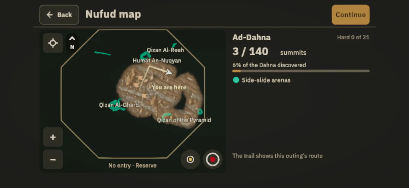
Driving uncovers the land around your truck, and each summit you climb uncovers the land around it. The “Discovered” line shows how much of the Dahna you have uncovered.
Three markers to help you read the map.
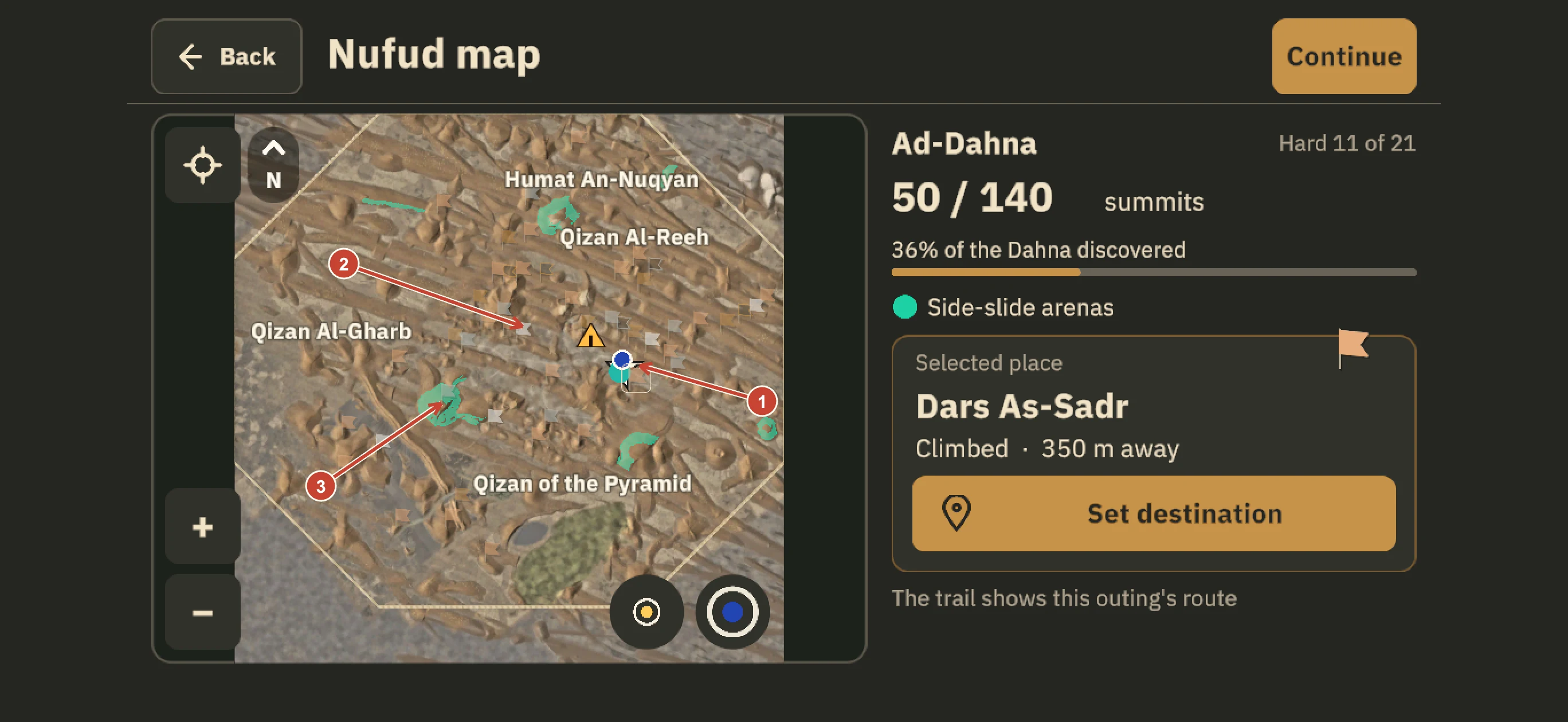
- 1
White arrow: you are here.
It shows your truck’s position and heading. Use Recentre after browsing.
- 2
The flag of a summit you climbed.
Its colour shows the flag rank. A faded flag is down after a counted climb and returns to normal once it stands again. Nearby climbed summits group under a number when zoomed out.
- 3
Turquoise: side-slide areas.
Turquoise patches on the map mark side-slide areas. Choose your line across the dune face.
Flag rank records your climbs.
Unclimbed summits stay hidden even if you have seen them: no symbol, name or question mark. Climb one and its flag appears on your map.
See flag ranks and how to earn them →Know the map controls.

Recentre
Returns the map to your truck after you pan away.

Zoom in +
Zooms in and separates grouped summits.

Zoom out −
Widens the view so you can see more terrain.

Minimap range
The gold-centred circle switches the minimap between a near and far range.

Abu Saad’s dot
The blue circle shows or hides Abu Saad’s map dot. It does not move him.
Control details from the game. N and its arrow indicate north. Set a destination with the guidance button, clear it with Remove pin, and close the map with Back or Resume.
Choose a destination before driving.
Select a summit or place.
Zoom in if symbols are grouped. Select your target to see its name and distance.
Set it as your destination.
A guidance line points you towards it. Follow the direction and choose your own line across the dunes; selecting a place does not teleport you.
Read your recent trail.
Your trail shows your recent driving route. Remove the pin when you no longer need that destination.